Welcome to the Driftless Region blog! I started this blog in the fall of 2019 so that other local writers and I have an easy way to share some of our favorite places, activities, and assorted bits of local pride and strangeness with anyone looking for some new adventures. If you’re not from around here, its also our way of introducing you to places here in the Driftless Area, that curious patchwork of steep valleys and rolling hills that make this part of the country look so different from the rest of the generally flattened-out Midwest.
[If you’ve been here before, jump ahead to our recent articles!]

.jpg)
This is “the land the glaciers forgot,” a strange geologic anomaly running across four states. The fact that no glaciers covered this area accounts for the plethora of rivers, caves, mounds, and occasional rare flora and fauna. Indirectly, perhaps it also connects to some of the other features that make this area unique, from the mining towns of the recent past to the dense network of conical mounds left by native peoples. By some accounts, there are more mounds here than anywhere else in North America, and archaeological remnants of people living here before the last ice age ended.

Of course, this isn’t just a geologic blog. You can also find articles here on local shops, clubs, and curious legends. Three different places in the Driftless Region claim to be the UFO capital of the world! If you have a story you’d like to tell, let us know: we’d love to publish your story.
To those from other parts of the Midwest, the Driftless Area looks, well, different. To use the words of blogger Maggie Koerth-Baker.
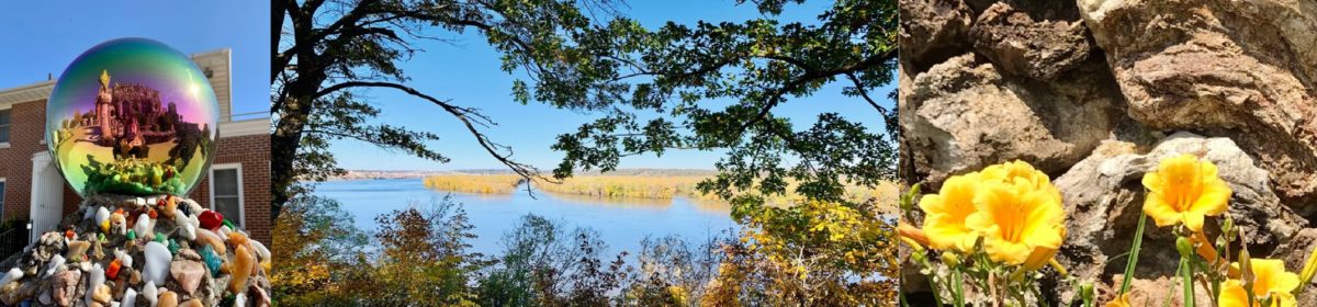
I was struck by the landscape, which felt exotic and foreign—adjectives that are seldom applied to southeastern Minnesota and southwest Wisconsin. The Mississippi here looks less like a river and more like a series of interconnected lakes dotted with sandbars, narrow peninsulas, and forested islands. Looking across the water, into Wisconsin, a line of strangely shaped tall hills (or maybe small mountains) run along the shore—all severe, sharp angles covered in a fuzzy looking blanket of trees. It almost looks like somebody cut a patch out of Appalachia and dropped it into the middle of the prairie.
“The Driftless Area: Wisconsin’s Strange Geology”
If you live here, you know something of the geologic history at least, since it is taught in local schools and abbreviated versions make their way into historical markers. But before we start talking about mysteries and mounds, caves and cave art, springs and sinkholes, river valleys, unique settlements and even UFOs, let’s take a moment to give visitors a short introduction to why this area looks so different from the rest of the Midwestern United States.
So just what (and where) is the Driftless Region?
Depending on who’s counting, the Driftless Area covers from 20,000 to 24,000 square miles, including almost all of southwest Wisconsin, a tiny sliver of northeast Illinois, and parts of northeast Iowa and southeast Minnesota.

It’s called “Driftless” because there’s no glacial drift here: no rocks or other debris, sometimes called “moraine,” left behind by the repeated crushing and scouring of huge glaciers during the last ice age.
During that age, huge glaciers, giant ice masses up to two miles thick, acted as both bulldozers and steamrollers in most of the surrounding area, flattening the landscape as they moved down from the north. Why they left this area behind remains a mystery, one we’ll eventually explore in this blog.

But after the glaciated Midwest became flattened pavement, the ice then slowly melted—leaving thousands of lakes in flattened Minnesota and parts of upper Wisconsin. But here, in what was already hilly land (and over by Devil’s lake Wisconsin, what was the oldest mountain range in the United States), the landscape became even more rugged as the melting glaciers carved the valleys even deeper.

The few flat areas in the Driftless Region generally run along rivers, most notably along the Wisconsin and Mississippi Rivers. If you stand along the bluffs of the Mississippi, you’re actually at what was river’s edge at the end of the ice age, when this river was the largest in the world: far bigger than today’s Amazon, Nile or Yangtzee. If you drive along any old road in the Driftless Region, odds are you’re driving along an old river bed caused by glacial melt from the surrounding areas.
Whatever caused the area to remain unglaciated, it’s left behind a truly unusual landscape. One of the first thing a casual visitor might notice is the mounds… the subject of first our article three articles.
What’s up next on our Driftless Road Trip?
Below, find a list of articles that have already appeared (but which no longer show up to the left under “Recent Posts.”)
The Mounds – an overview of Driftless Region Mound Complexes
The Platte or Platteville “M” Mound parts one and two
Winding North to Vernon County
Driftless Books and Music: The Most Eclectic Bookstore in Southwest Wisconsin
A Game for the Driftless Region: Rugby
UW-Platteville Pioneer Football
Road American: The National Park of Speed
Folklore Village: Dance Yourself into the Past
Be Mine! (Bevans Lead Mine and the Rollo Jamison Museum)
The Mick Hill (A Driftless Region Memoir by Gary Jones)
The Mysteries of Indian Park, Part 1 , Part 2, and Part 3, plus Laurie Graney’s research on Indian Park as of March 2020
Conical Mounds, Linear Mounds, Effigy Mounds
What Did Platteville Look Like in 1827?
Fall Color in the Driftless Region
Winter in the Driftless Region
Driftless Lore by Nettie Potter
How to submit
Do you have a driftless region road trip you’d like to share with us? If you have a story about a favorite place or activity in the land the glaciers forgot, here’s how to submit it to us. We’re particularly interested in getting some good pieces about winter activities or hunting or fishing, since we have none so far.