(or should we say, “Mootz”?)

Today’s article won’t be long. But for those of you who are interested in the large mounds in the area– a list across three states that includes the Platte, Belmont, Blue, Horseshoe, Charles, Sherill and Sinsinawa Mounds–you sometimes see reference to a, or the, “Little Mound.”
For instance, at the top of one of the Blue Mounds, you even can see a diagram that shows you where “Little Mound” is, about 24.5 miles southwest of the Blue Mound right between the Belmont and Platte Mounds. If you’ve been to either of the latter two places, you may have driven right by it (and if you did, did you try to read that word on the western side? What does it say?)


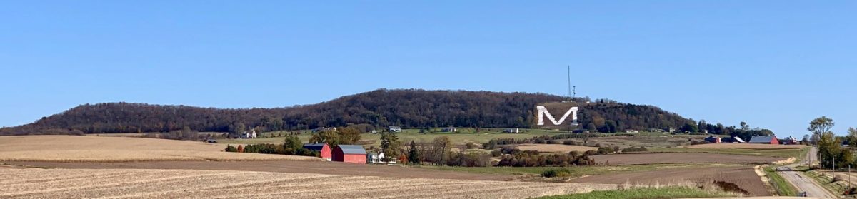
“Little Mound” sits about a half-mile west of the Belmont Mound (and about a half-mile east of the Platte or “M” Mound) on County Highway B. It’s on private property, and was once part of a large farm belonging to Don Mootz… and that, plus the large “M” for “Mining” on the Platte Mound, is probably why it too sports a large “M”… in this case followed by the rest of the “Mootz” name! It was very visible even ten years ago, but has become illegible in recent days.
Below, have a look at the Little Mound in winter… and that’s it for today’s road trip!

Unless noted, all photos by Terry Burns
Tell us about your favorite place in the Driftless Region!